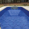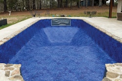


Leaping into a large swimming pool construction project without a thorough visualization of the surrounding area is like diving, head first, into a pool without knowing the exact depth. Before you take that first swan dive, in either scenario, you must have a complete knowledge of the playing field.
Through technological advances in the world of aerial imagery, that hesitation while standing at the edge of the high dive or project launch date becomes nearly non-existent. High-resolution aerial imagery provides pool and spa contractors with crystal clear images ready to be used in prospecting and building out proposals, capturing accurate measurements and even viewing the site over time in leaf-off and leaf-on seasons.
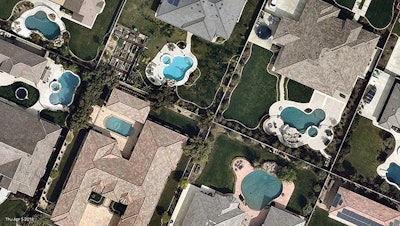
Nearmap, a location content provider specializing in high-resolution aerial maps, for example, offers frequently updated, high-definition aerial photos of 430 urban areas across the United States. Compared to other imagery sources such as free satellite maps, Nearmap is several times sharper and more up-to-date.
Using advanced aerial images, captured multiple times a year, pool and spa contractors can now save time prospecting and building out custom proposals, properly assess site conditions from season to season and create detailed and accurately measured designs with ease.
Save Time Prospecting and Building Proposals
With aerial imagery, delivered through the cloud directly to desktop, laptop or even mobile devices, there is no need for pool contractors to spend excessive hours in the field surveying locations of prospective clients and measuring recently contracted projects.
Initial planning, data collection and inspections can now be completed from the comfort and safety of the office, speeding up contractors' workflow. Now contractors can deliver more estimates per day while eliminating costly site visits. Potential customers can also be qualified over the phone in real-time, too, as contractors easily take measurements, locate access points for heavy equipment and assess land conditions using highly detailed imagery.
Proposals featuring those high-resolution images, too, are sure to impress clients, illustrating with clarity the proposed design and expected scope of work.
Looking for prospective customers in the neighborhood where you've just installed a stunning backyard oasis? Use aerial imagery to identify ideal future clients, sending out a sales team with a customized pool proposal in-hand, appealing to that desire to "keep up with the Joneses."
 Nearmap's high-definition maps helps users save valuable time and create impressive presentations for clients.
Effectively Assess Site Conditions Over Time
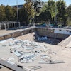
When plotting out the construction plans of a new swimming pool, contractors have a great deal of information to study — soil conditions, water table levels, ease of access to the site, proximity to the home's foundation and other structures, locations of utility lines, and more. Rather than physically walk every inch of the homeowner's property to measure surface areas and mark utilities or other hazards, that information can easily be discerned from vertical (top-down), panorama (bird's eye view) and even oblique imagery. For example, what might be confused as a trampoline in a previous satellite image can now be more accurately identified as a gazebo through a high-resolution panorama image.
Renovation projects on existing pools and spas, too, benefit from viewing property changes over time. Images captured during leaf-off and leaf-on seasons prove beneficial when considering how a particularly leafy tree might impact prime sun tanning or how often the pool or spa might need to be cleaned. Degradation of concrete and other hardscapes surrounding the pool, too, can be identified by viewing images over the previous years and indicate settling, water damage or other larger concerns. Utilizing aerial images that are captured multiple times a year provide additional insights into all those critical details.
Outline Design Plans With Ease
When mapping out a construction plan for creating that poolside paradise, capturing precise measurements is critical. Those numbers are crucial for design, from the actual surface area of the pool to the depth of the excavation to the proximity of the home or other permanent structures to even the access areas for the heavy equipment needed for the excavation process.
Pacing out every inch of the property in person becomes exceptionally time consuming, especially when factoring in drive time to and from the location. With aerial imagery, however, those initial measurements can efficiently be calculated within seconds from the comfort of the office and then later confirmed when the team is actually on-site.
When it comes to creating or even renovating the perfect backyard oasis, there are multiple ways high-resolution aerial imagery will not only save pool and spa contractors time and money, but also open the doors to even more prospecting opportunities.
For more information, visit go.nearmap.com or call (844) 463-2762.